2016 Ham 14er Weekend
This past weekend was one of my favorite of the year - it was the annual Ham Radio 14er event. This year marked the 25th anniversary of the event, and the first year that the event has spanned the entire weekend instead of just the first Sunday in August. In combination with opening up all SOTA peaks last year, this did wonders to open the event to many more people from a lot more locations.
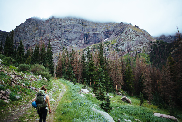
A few weeks ago I started planning. I was to drive to a trailhead Friday night, then spend Saturday and Sunday summiting 14ers, and as many as possible! In the back of my head, I knew I wanted to do the Crestone Traverse, a 4th-class saddle between Crestone Peak and Crestone Needle that I've had my eye on ever since I did the Blanca Peak to Little Bear traverse a couple years ago. So I pegged that for Saturday, then Sunday I could go up one of the other three peaks in the area - easy peasy.
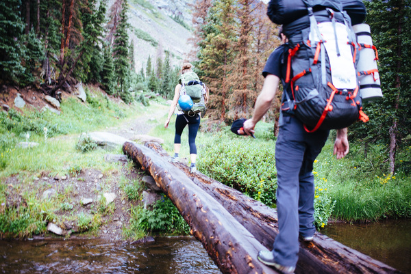
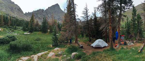
I took the afternoon off work on Friday and hit the road. On the way up the 4x4 trail to the hiking trailhead, I came across a stuck Toyota Matrix, which I was able to nudge up the tricky section with my winch. The occupants were headed the same place as me with the same goal of the traverse on Saturday, so we stuck together. After getting our cars up to the trailhead, we started the ~5 mile hike up to South Colony Lake just after 6pm.
We got to the lake after dark, so I immediately set up camp and grabbed a quick bite to eat before passing out in anticipation of the long day ahead. It started raining a few minutes after I got the fly on the tent, so I made the decision not a moment too soon! I also coordinated with my new friends and agreed we wanted to hit the trail before dawn, so we set a time to meet - 5:30am.
I woke up to ... nothing.
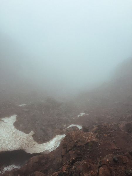
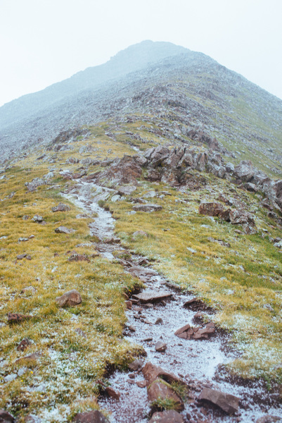
There was moisture in the air, and the campsite was completely socked in with very little visibility. I didn't come all this way to bail, though! I made my cup of coffee and ate an energy bar, and with no sign of my summit buddies I decided to head up without them. The sun tried so hard to peek through the clouds!
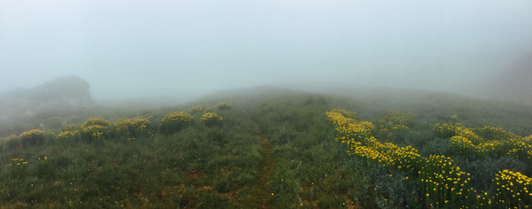
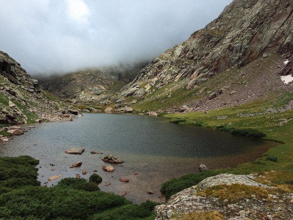
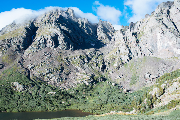
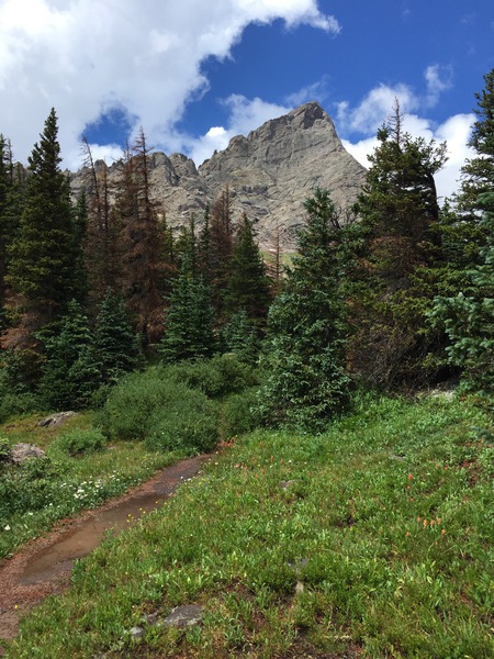
As soon as the sun got a little higher, visibility dropped back down to ~50 feet or so. It made for a rather boring hike - until I almost tripped into Cottonwood Lake! I had been hiking right next to it for several hundred feet without even knowing it!
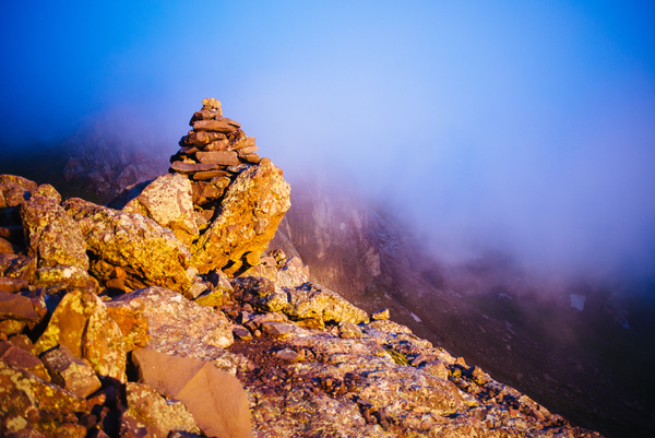
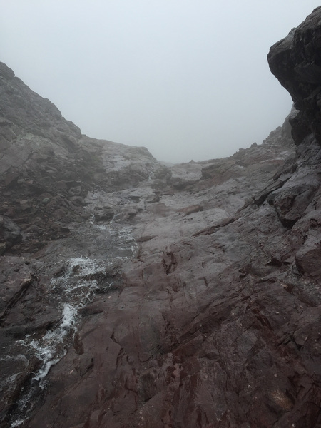
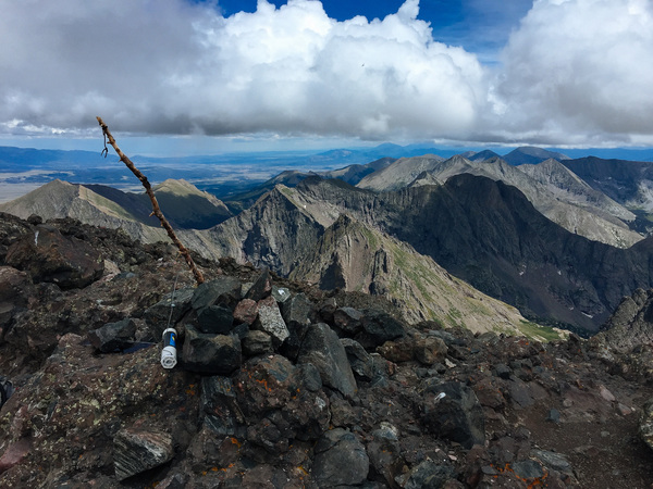
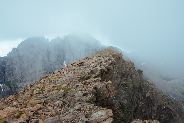
My camera lens got completely fogged over in short time, so I don't have any more photos of the ascent. After several hours of class three scrambling in the "Red Gully", with only my map to guide me, I reached the summit! Visibility was still next to nothing and the wind was biting and cold, but I set up my radio and tried to make some contacts.
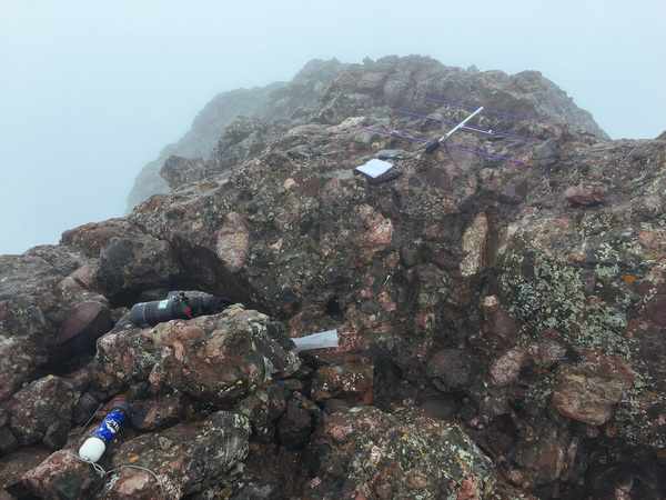
I made a handful of contacts, enough to activate the peak, anyway, and decided to get down ASAP!
Crestone Peak Activator Log - W0C-LG001 - KI6YMZ
| Time | Call | Band | Mode | Notes |
|---|---|---|---|---|
| 15:30z | K0JQZ | 144MHz | FM | |
| 15:33z | W0BV | 144MHz | FM | |
| 15:35z | N0LNE | 144MHz | FM | Scott |
| 15:37z | K3ILC | 144MHz | FM | PR-089 |
| 15:39z | WA6MM | 144MHz | FM | SR-004 |
| 16:00z | AF5KS | 144MHz | FM | |
| 16:05z | WA6TTY | 144MHz | FM | Woodland Park |
| 16:30z | K0NR | 144MHz | FM | Bob |
| 16:35z | N0LP | 144MHz | FM |
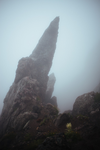
On the descent, I decided that doing a 4th class traverse with notorious tricky route finding with zero visibilty in the rain - alone - was not a great idea. I made my way down the red gully, which given the visibilty and slickness of the rock in the rain proved to be quite an adventure!
By the time I had reached Cottonwood Lake again, the weather seemed like it wanted to clear, albeit a tiny little bit!
Given that the sun was starting to peek through the clouds a bit, I stopped for an hour or so at the lake to eat lunch and dry out my soaked clothes.
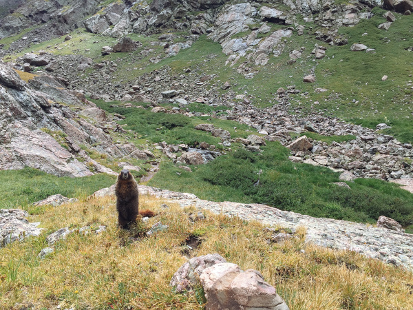
I met some local wildlife, including a marmot that would not leave me alone!
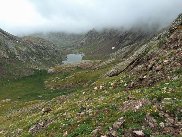
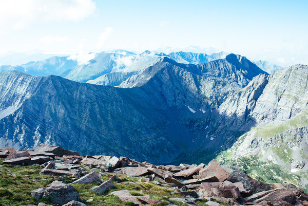
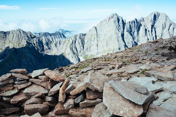
I continued the hike out, and at a saddle just below Crestone Needle the sun came all the way out.
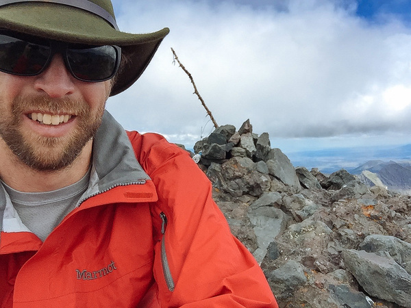
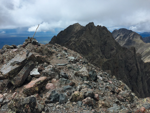
I checked the map, and the summit of the Needle was less than a mile away, with a whole lot of 3rd class scrambling to get there. I looked around and the clouds were clearing in every direction, so I made a gamble and decided to go up the standard route of the Needle as well.
Luckily I had the 14ers.com app on my phone that listed the directions for the route, it was indeed a lot of scrambling and tricky route finding. A map alone would not have sufficed! At around 2:30 or so - much later than I am comfortable admitting - I made the summit of Crestone Needle.
Given that it is not a SOTA peak due to its proximity to Crestone Peak, I didn't keep a log of contacts from the summit. There weren't any other peaks on 146.52, and I just talked to a couple guys that were driving on a nearby highway.
I didn't want to spend any more time on the summit than I had to, so I headed down quickly. There were again some tricky sections, but I have been climbing a long time so I felt pretty confident on the solid rock. At times, there were even some bail slings left by other parties on the descent!
Once back to the South Colony Lake, I set eyes on my camp for the first time in the light. Not bad, considering I picked it and set it up in the dark!
I made it back just after 4pm, and tooled around camp a bit. By 6pm I was completely exhausted so retired to the tent - just as the rain started again! I made dinner in the tent and must have been asleep by 7pm.
Given the length of the day, how wet I was, and how miserable I felt I decided that if there was even remotely bad weather on Sunday I would just pack up and head home. I didn't even set an alarm, because I figured I wouldn't be going anywhere.
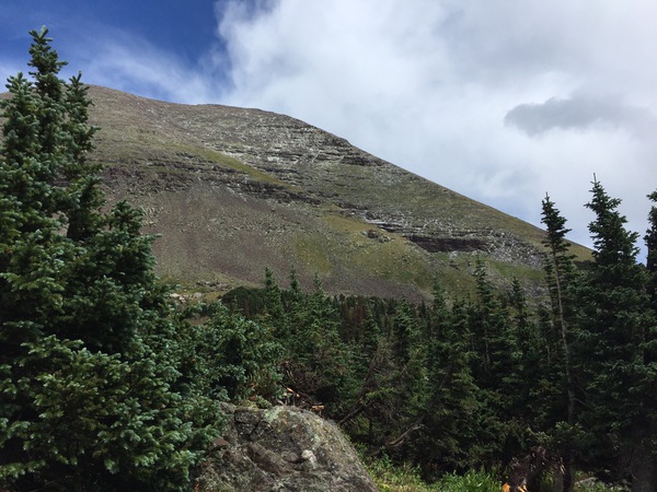
But then I woke up at 6:30 on the nose on Sunday, and there was not a cloud in the sky! I made myself a cup of coffee, put on my wet shoes, and started the comparatively-easy hike up Humboldt Peak at 7:15 or so.
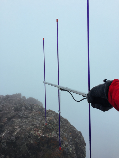
I made the summit in good time, right around 9:30am without a cloud in the sky. I worked the radio for almost an hour, trying to make as many contacts as possible on the 2m Yagi.
Humboldt Peak Activator Log W0C-SC-001 - KI6YMZ
| Time | Call | Band | Mode | Notes |
|---|---|---|---|---|
| 15:30z | KT0AM | 144MHz | FM | Mt. Huron |
| 15:38z | KD5ZZK | 144MHz | FM | |
| 15:40z | K0MGL | 144MHz | FM | Greg, Teller County |
| 15:45z | N0XDW | 144MHz | FM | |
| 15:55z | KD0WHB | 144MHz | FM | Mt. Evans |
| 16:00z | K9DBX | 144MHz | FM | Mike Mt. Evans |
| 16:02z | N0MTN | 144MHz | FM | Mark, Mt. Bierstadt |
| 16:15z | N4MMI | 144MHz | FM | SR-003 |
| 16:17z | K0NR | 144MHz | FM | SP-058 |
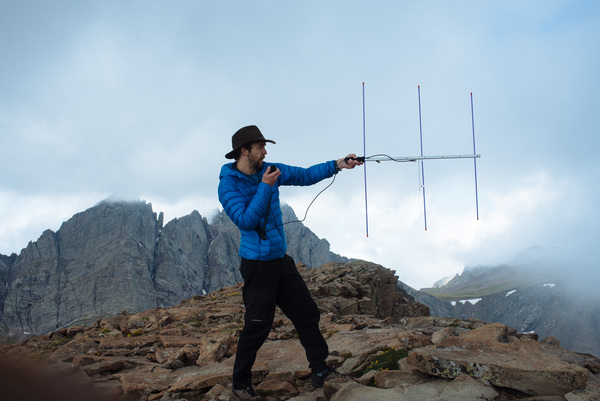
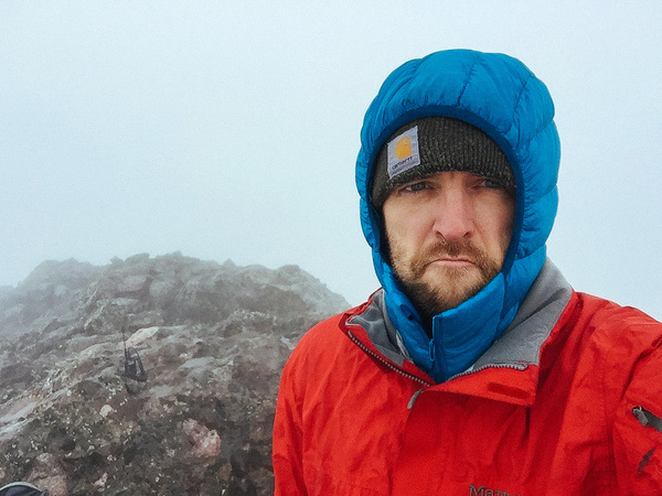
At 10:15, I looked up and noticed that while I was playing with the radio some clouds had indeed gathered around me. I took one last self portrait (above, with Yagi) and packed up and started down rather quickly. There is very little cover at the summit, so I wanted to get out of lightning strike range as soon as possible!
With my luck, it started hailing about 20 minutes and 800 vertical feet later. It started off slowly, but then with a giant thunderclap it started pelting me harder and harder, almost painfully so! I kept running down, passing two other hopeful ascent parties waiting out the storm.
I made it back to camp where it was only raining, and decided enough was enough. I threw camp together hastily and hit the trail back to my car and home.
The tracks of my movement are available for viewing and download at Gaia GPS.